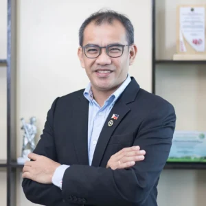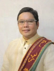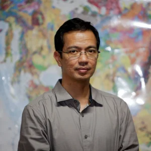

The Builders of NOAH
By Danielle Uy Lim
Nearly every monsoon season, the story repeats: schools close, homes flood, lives are lost. At its worst, the rain has a name. PAGASA calls it torrential. Dr. Mahar Lagmay has a plainer definition: “It’s when you cannot see the road even if the windshield wiper is set at its fastest,” he told a UP Alumni Association forum in 2013.
The wording matters. Lagmay’s aim, he explained at the same forum, was to turn a technical term into something people could picture. Flash floods can kill within seconds, he said, and science is useless if people don’t understand it.
Thirteen years later, he holds NOAH to the same test. Now run by the UP Resilience Institute (UPRI), NOAH (Nationwide Operational Assessment of Hazards) gives free hazard maps and flood information to the public, local governments and national agencies.
When the national government released ₱1 billion to expand it in 2026, Lagmay said the results “will be measured by better information, transparency” and fewer losses. That has been NOAH’s guiding idea since its founding: hazard data belongs to the people it can protect, and it protects them only if they can make sense of it.
“Arko laban sa delubyo”
On December 16, 2011, Tropical Storm Sendong struck Cagayan de Oro and Iligan. PAGASA had issued Storm Signal No. 2 three days earlier, but many residents dismissed it. As families slept, floodwaters rushed into their homes. By the NDRRMC’s count, 1,268 people died.
The storm exposed a gap. A signal could warn a whole province, but it could not tell each family what to do. Should they stock up on emergency goods? Or was it time to evacuate? The government wanted to close that gap.
Much of the science already existed, scattered across projects funded by the Department of Science and Technology (DOST). Each covered part of what a flood warning needs: where rain was falling, where it would fall next, and where the water would go. One team was building weather sensors. UP geologist Dr. Carlos Primo C. David was working to sharpen rainfall forecasts. Dr. Enrico C. Paringit, a UP geodetic engineer, led DREAM, a new program to map flood hazards. After Sendong, DOST combined the three with several new projects into one program: Project NOAH.
To lead it, Paringit and DOST officials tapped Lagmay, a UP geology alumnus (BS 1987, MS 1993) and professor at the university’s National Institute of Geological Sciences. In July 2012, President Benigno Aquino III launched the program, calling it the country’s “arko… laban sa delubyo.” Its goal was six hours’ warning before a flood.
DREAM was NOAH’s biggest component. Starting in November 2012, Paringit’s team at UP’s National Engineering Center flew planes over the country’s 18 major river basins. Lasers on the planes, a technology called LiDAR, measured the shape of the ground below in fine detail. From those measurements, the team made 3D maps showing where floods would spread.
That December, Typhoon Pablo hit Mindanao. This time, Cagayan de Oro was ready. With about a dozen automatic rain gauges on its rivers and overhauled disaster protocols, the city urged residents in danger zones to leave a day before the storm. It recorded zero deaths. Months later, the city became one of the first local governments to test DREAM’s flood maps. “Important yung information at yung early warning,” Cagayan de Oro engineer Elpidio Paras later told a DREAM forum at UP.
By late 2013, more than 700 new weather sensors had been installed across the country. Their readings streamed to NOAH’s website alongside satellite images, Doppler radar and the new flood maps. All online and free for anyone to see.
“Give the information to them”
At the 2013 alumni forum, Lagmay argued that hazard information belongs to the public. “Give the information to them; it’s their right, it’s their lives!” he told the audience.
But open data does nothing if nobody looks at it, and Lagmay knew it. He once posted a satellite image of an approaching storm’s track on Twitter and got about 40 retweets. Reposted with the caption “Retweet for a better love life,” the same image more than tripled that. The science hadn’t changed, only the way it was shared.
He passed that thinking on to his team. Patricia Anne S. Delmendo finished her geography degree at UP in 2011, when, she says, the discipline “really wasn’t known or recognized.” Friends from the department later persuaded her to apply to NOAH, where she now works on the flood modeling team. In more than 12 years with Lagmay, she says, he has given his researchers the freedom to explore and taught them to think big. “A methodology, an approach, or an analysis that may seem like an academic exercise to us may actually have practical applications that can help reduce disaster risk.”
“A program in need of a home”
But NOAH was never spared from storms. Everyone except Lagmay and Paringit worked on contract, and in 2016, their pay was delayed five months. Budget cuts also halved the team.
“Since the beginning, when it was still a government program, we sometimes had to go for months at a time without our salary,” Delmendo says. “Not everybody had the privilege or inclination to work under those conditions.”
Then, in January 2017, DOST said NOAH had delivered what it promised and that its technologies should pass to agencies with the mandate for them, chiefly PAGASA. Funding would end on February 28. Some 40 researchers and scientists stood to lose their jobs. At a January 31 press conference, Lagmay pleaded for them. “They work beyond the call of duty,” he said. The people, he argued, mattered more than any technology NOAH had built.
Five days before the deadline, UP stepped in. On February 23, the Board of Regents voted to adopt the program. “We were a program in need of a home,” Lagmay said in the university’s announcement. Then-UP President Danilo Concepcion put it more warmly: “In a sense, Project NOAH is coming home.” Within a month, NOAH was re-established as the UP NOAH Center, and that June it became part of UPRI, which Lagmay now leads.
A home, though, was not a full budget. NOAH made do with a fraction of what it once had. “When Project NOAH was discontinued, everybody had to go on to find other opportunities,” Delmendo says. “So many hardworking, talented, and dedicated people had to leave NOAH that way, and a lot of these people were the ones who built NOAH through the years.”
“A map is not the end”
Eight years on, amid a controversy over the government’s flood control projects, lawmakers turned to NOAH. In December 2025, Rep. Mikaela Suansing proposed adding ₱1 billion for the program to the national budget, asking in return that NOAH work more closely with the DPWH on how flood control projects are designed and monitored.
The funding reached UP in August 2026. It will make NOAH’s maps far sharper, with each point covering one square meter instead of a hundred, Lagmay told BNC. About half the budget will go to equipment, including LiDAR drones that state universities and colleges will fly to map the country; artificial intelligence will help NOAH forecast floods.
UP President Angelo A. Jimenez was clear about what the tools are for. “Technology is not the end. AI is not the end. A map is not the end. A model is not the end. The end is a safer Filipino community,” he said.
Reaching those communities is the unfinished work. “Floods do not recognize administrative boundaries,” Lagmay said at a press conference after the funds were released. But local governments do. UPRI has worked with at least 20 of them in eight years, in a country of more than 1,600 cities and municipalities.
A bill in Congress could help see that work through, turning UPRI into the UP National Climate Resilience Institute with a national mandate. As of this writing, House committees have approved a substitute version.
“A culture of preparedness”
How much NOAH has helped is hard to measure. The team has tried to count the disasters it helped avert, Delmendo says, but proving a negative is difficult. What made it real for her was smaller. People once barely checked NOAH’s website, even during typhoons. Then, a couple of years ago, an acquaintance posted that they had used it to see how far floodwater reached on their street, and even to plan ordinary days. “It was a good feeling for me,” she says. To her, it was a step toward a culture of preparedness.
That culture is the real goal. “The key to a resilient Philippines is embedding hazard and disaster knowledge into our culture and practices,” she says. It sounds simple, she admits, but the goal is so large that it is easily lost in the noise. “As a UP graduate, I think that part of my duty to the public is not to lose sight of that direction and that goal.”
Lagmay puts it more bluntly. “Kahit na anong science pa ang meron tayo, if the people do not embrace the science, it is meaningless,” he said at the same press conference. “We need to communicate better so that the people can understand better what the science tells us we should do.”
Thirteen years after he defined torrential rain with a windshield wiper, he is still trying to help people see the road.